Bus Stops: The Good, The Bad, And The Ugly


Just an unremarkable stop. What’s special about that?

As caption and subsequent text
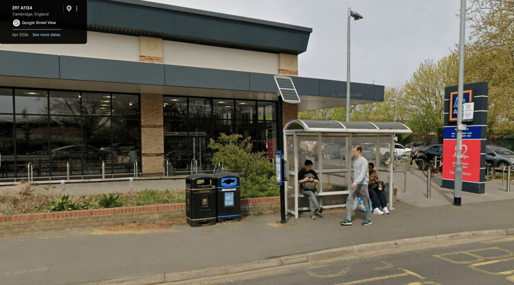
Stanley Road (outbound) 0500CCITY165 (outside Aldi, Newmarket Road, Cambridge). Click the image to explore on Google Maps.

At first glance this is an unremarkable stop. There are, however, a number of features which suggest that whoever commissioned and installed the infrastructure was actually thinking about the needs of bus passengers.

This stop is provided with a shelter, with integral seating, set back at the edge of the highway boundary. A bus stop flag has been mounted on an adjacent street-lighting column. Real-time passenger information, of e-paper type, powered by a solar panel, is installed close to the shelter at the upstream end. A lockable case contains printed route/timetable information. There are no obstructions for passengers boarding/alighting. Litter bins are well-sited. A raised kerb aids easy boarding/alighting, which is of particular benefit to wheelchair-using passengers and parents with children in buggies.


What’s so bad about that? There’s a shelter.

As caption and subsequent text
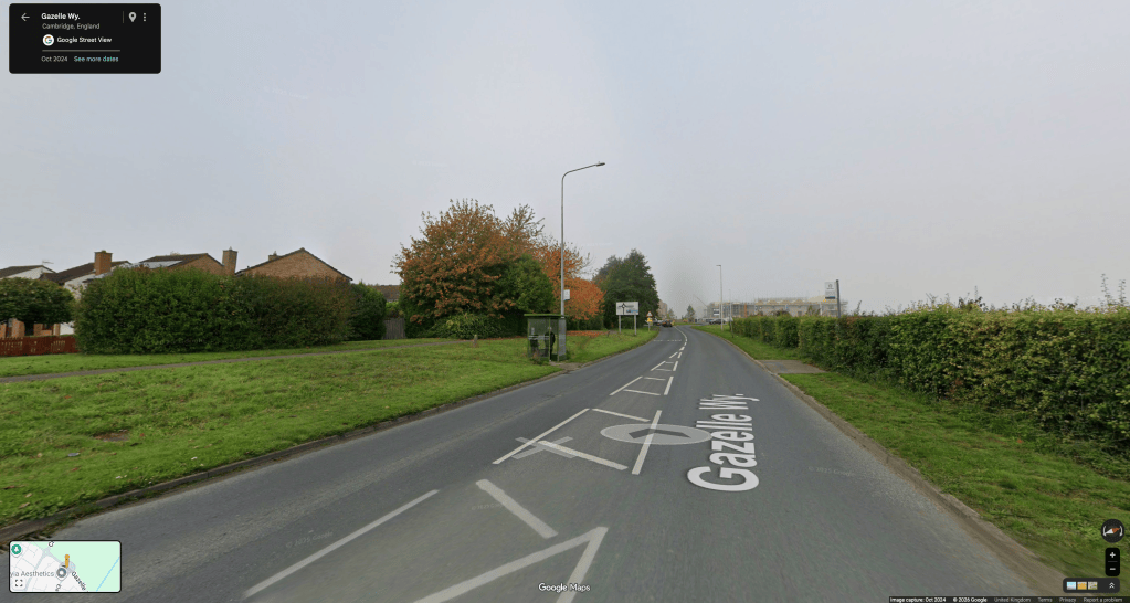
Eland Way (NaPTAN 0500STEVE013) towards Addenbrooke’s and city (left) and (NaPTAN 0500STEVE016) towards Tesco and Fulbourn (right) on Gazelle Way Fulbourn/Cherry Hinton. Click the image to explore on Google Maps.

Addenbrooke’s and city-bound passengers benefit from a shelter with integrated seating and hardstanding, whilst Fulbourn-bound passengers have no shelter. Both stops benefit from timetable cases, although the city-bound timetable is cunningly hidden the wrong side of the lamp-post. However neither stop could be considered accessible. Reaching the stop on the left involves slithering down a grassy bank; the stop on the right additionally involves the hazard of crossing a 40mph road with no pedestrian crossing.


Another one with a shelter? Are we being picky?

As caption and subsequent text
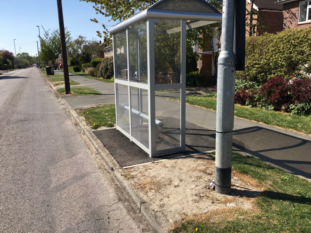
Almoners’ Avenue (NaPTAN 0500CCITY267) on Queen Edith’s Way towards Cherry Hinton. Click the image to explore on Google Maps.

There is, indeed, a shelter, with hardstanding and integrated seating, and a printed timetable in a locked case. However, neither the contractors nor whoever commissioned the infrastructure seem to have considered where passengers would board, or alight from, buses. The adjacent patch of parched, dry soil is fine for able-bodied passengers in good weather.

When that patch is wet, muddy and slippery, it is a hazard for all passengers, but particularly those using wheelchairs or other mobility aids.

PS: explore this stop on Google Maps. Should it now be in the ‘Ugly’ category?


Ah, point taken.

As caption and subsequent text
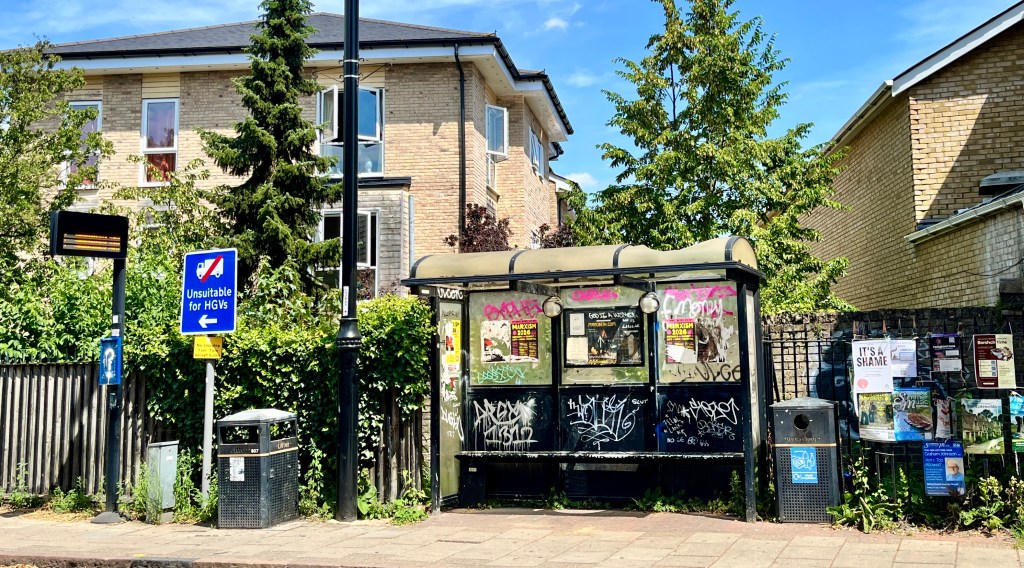
The bus stop infrastructure at Gwydir Street stop (towards Addenbrooke’s, NaPTAN 0500CCITY404) on Cambridge’s Mill Road. Click the image to explore on Google Maps.

The shelter has a broken roof, is covered in graffiti and fly-posting. The pole supporting the adjacent real-time passenger information display also hosts a timetable case, which is empty and graffitied. We are uncertain who is responsible for this shelter…


Responsibility for bus stops in the Cambridge area is split between various bodies. Here is brief digest:

  • Cambridgeshire County Council (the Highway Authority) is the body which has traditionally approved the siting of bus stops – although the Cambridgeshire and Peterborough Combined Authority is now the Transport Authority, so there are overlapping responsibilities.
  • Bus stop locations should then be entered on the National Public Transport Access Nodes (NaPTAN) database.
  • The Combined Authority and/or Highway Authority is responsible  for providing good hard-standing for bus stops; and should provide a bus-stop pole, unless an adjacent street-lighting column can be used.
  • Provision of a bus stop flag is, currently, the responsibility of the bus operator, as is a timetable case and printed timetable.
  • Real-Time Passenger Information displays (pole-mounted, integral within a shelter, or of the more modern, compact e-paper type), if provided, is the responsibility of the Combined Authority. The RTPI feed is operated by contractor Vix Technology on behalf of the Combined Authority.
  • Bus shelters are, generally, the responsibility of the lower-tier authorities (eg Cambridge City Council, South Cambridgeshire District Council) who may have agreements with advertising companies (eg Bauer Media Outdoor UK, formerly Clear Channel/JC Decaux) which provide and maintain some shelters (in return for the right to sell static or moving advertisements). Additionally Parish Councils may choose to install shelters and seating. (Good examples can be found in the Histon & Impington and Great Shelford parishes.)
  • However, when roads are re-modelled (Hills Road, Histon Road, Milton Road) using Greater Cambridge Partnership money it is unclear who has responsibility for design of siting of stop and shelters.
  • Cambridge Area Bus Users is not aware of the existence of any bus stop design manual published or followed by the Combined Authority to guide new installations, or programmes of improvement.

Cambridgeshire and Peterborough Combined Authority have a poor inheritance, from when Cambridgeshire County Council were the Transport Authority.

Back in April 2019, a (then) senior county councillor and (then) public transport officer, explained that:

Bus stop locations are the decision of the county council in consultation with bus operators and are then entered on the National Public Transport Access Nodes (NaPTAN) database. A pole may be provided where a convenient piece of street furniture, such as a street lighting column, is not available. It is the responsibility of the operator to mount their flag on the pole. Timetable frame and flag are installed by the bus operator. Only about half the stops have a flag, the rest are unmarked.

It was only on 15th November 2023, following public questions on behalf of Cambridge Area Bus Users, that the Cambridgeshire and Peterborough Combined Authority’s Transport & Infrastructure Committee agreed that:

(7.2.e) The CPCA would go through an options process to understand what was the right approach for a combined authority to take in regard to ownership and maintenance of bus stop infrastructure.

Translation: The Combined Authority know the locations of bus tops (from the NaPTAN database) but we’ve no real idea what’s installed at each location: pole? bus stop flag? timetable case?shelter? seat? Oh, and we don’t really know who installed what, still less who is responsible for maintaining what.

The Deputy Mayor at that time, Anna Smith, did promise that there would be a nominated officer charged with oversight of bus stop infrastructure. See: Transport & Infrastructure Committee Draft Minutes Wednesday 15th November 2023.


At the Cambridgeshire and Peterborough Combined Authority Transport Committee on 4th March 2026 a programme of Bus Stop Infrastructure Improvements was agreed.

To see if there are improvements planned for a bus stop which you use, read/download the Bus Stop/Shelter Infrastructure Improvements programme PDF produced by Systra for Cambridgeshire and Peterborough Combined Authority. The criteria for selection can be found in this report to the committee: Bus Stop/Shelter Infrastructure Improvements Report.


The October 2023 joint position paper from Cambridge Area Bus Users and Living Streets, Cambridge has a good summary of our views. Additional links are provided for those who would like to read more.


  • Our Executive Committee diligently report failures of the RTPI system – both of hardware and data.
  • We are looking, more strategically, on why some services do not seem to track, or to give a realistic estimate of bus arrival times.
  • A survey of printed information (or the lack thereof) at key locations is also being undertaken.
  • Our Executive Committee member for St Ives has worked with others to produce an information leaflet and vastly improved printed information in and around St Ives Bus Station.

All of these will form the subject of forthcoming posts.


Combined Authority Bus Network Review

Cambridgeshire and Peterborough Combined Authority recently undertook a public consultation on what they described as a “Bus Network Review” (PDF). Note this “consultation” is now closed.

Cambridge Area Bus Users could not really see the point of spending time and money on these short-term changes, which simply replace one set of partly-unsatisfactory routes and times with a set that’s marginally improved, but which remains straitjacketed by the need to avoid conflicting with “commercial” services. So the revisions don’t necessarily make problems go away, and they won’t until we have franchised services that can combine sections from the current “commercial” and “supported” sectors into one meaningful county-wide network. See our explainer on Franchising.

The Bus Users’ group has been very concerned, for some time, by the limited promotion of Cambridgeshire and Peterborough Combined Authority-supported bus services. This directly links to the use (and, therefore, viability) of these services. This consultation, similarly, did not appear to be directly promoted to the bus passengers it is going to affect (eg at key bus stops).

It’s unfortunate – but not unexpected – that the Combined Authority’s concept of a “bus network” extends only to routes and timetables. The continued lack of through fares where connections are to be made (even when these are all under CPCA control) and the continued exclusion of some services from the Multibus* scheme – even when they’re operating Cambridgeshire and Peterborough Combined Authority-supported services (you would expect signing up for Multibus to be a contractual requirement) – rather diminishes the concept of a “bus network”. Apparently ticketing isn’t thought of as an element of the “bus network”. It definitely is by passengers!

*Some information on the Multibus scheme is available on the hard-to-find TransportCPCA » Home » Buses » Bus tickets page.

Read/download Cambridge Area Bus Users’ response to the Combined Authority Bus Network Review (PDF).


Hi there,

I hope this email finds you well.

Thank you for signing up to receive updates on the Bus Network Review engagement.

The public engagement has now closed, and we’d like to thank everyone who took the time to share their views. We received over 1,000 responses from residents across Cambridgeshire and Peterborough, providing valuable feedback on the proposed changes to local bus services.

We are now carefully reviewing all of the feedback. This will help us refine the proposals before they are presented to the Combined Authority Board in September.

No decisions have been made at this stage. Members of the Combined Authority Board will consider the revised proposals before deciding on any future changes to the bus network.

We’ll continue to keep you updated as the project progresses and will let you know once the Board has considered the proposals.

Thank you again to everyone who took the time to get involved. Your feedback will play an important role in helping shape the future of local bus services across Cambridgeshire and Peterborough.

Kind regards,
Communications Team
consultations@cambridgeshirepeterborough-ca.gov.uk
Tel: 01480 277180


September Bus Changes

There is much to welcome in the September changes to bus services in and around Cambridge announced by Stagecoach and WhippetStagecoach changes from Sunday 1st September, New Whippet service 18a from 2nd September – with increasing funding from Cambridgeshire and Peterborough Combined Authority.

Some services are being ‘rationalised’ (Stagecoach’s citi1 in Fulbourn) others have longer journey times (citi7) or reduced frequency (citi6) whilst others have, currently, no prospect of returning to pre-Covid frequency levels (citi2 every 20 mins, 10 mins pre-Covid).

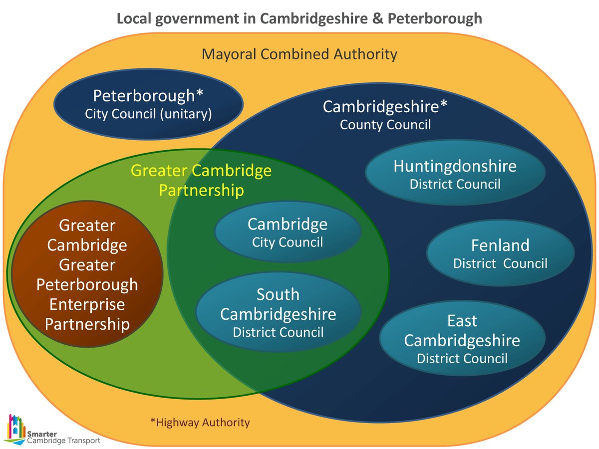
Cambridge Area Bus Users recognise that commercial bus companies cannot run services at a loss. Adding extra buses to maintain frequencies adds costs, without any certainty of increased farebox revenue. Unless our plethora of overlapping local governance bodies (see graphic, below) take radical action to tackle traffic congestion bus services will be in a spiral of decline: reduced speeds ➞ increased costs ➞ lower ridership ➞ reduced income ➞ service reductions ➞ lower ridership ➞ reduced income ➞ further service reductions.

Venn diagram giving visual representation to the overlapping responsibilities of district, unitary and county councils with Cambridgeshire and Peterborough Combined Authority and Greater Cambridge Partnership

In February 2024 sister organisation Cambridgeshire Sustainable Travel Alliance issued a press release – We will all lose out if the Greater Cambridge Partnership abandons large-scale projects to reduce congestion.

The current high motor traffic levels are hinted at as the reason for abandoning the road reclassification project. The Eastern Access project, Hills Road and Madingley Road schemes are also being watered down due to the need to accommodate large numbers of cars. It is highly inequitable that projects to encourage people to use sustainable transport and reduce car usage cannot go ahead or are compromised because there are currently too many people driving. Many people who drive would like to travel by sustainable means, but cannot. When GCP officers assessed the threats and opportunities of not proceeding with the Sustainable Travel Zone road charge last September, they did not mention that abandoning road charging would leave them unable to deliver other GCP projects. In hindsight, this is a significant omission.

CSTA press release as above

Silviya Barrett from national transport charity Campaign for Better Transport (a member organisation of the Cambridgeshire Sustaianble Travel Alliance) said: 

“The only way to tackle congestion is to reduce the number of cars on the roads. Traffic reduction measures, coupled with public transport improvements have been proven to cut congestion, reduce air pollution and make places more pleasant to work and live.”

Cambridge Area Bus Users has received multiple complaints about unreliable bus services; one member reported walking from the city centre to the Catholic Church faster than five buses crawling along in road congestion. The group cannot envisage significant improvements in bus reliability until congestion is tackled by reallocating road space away from private cars to buses and active travel.

We contacted David Boden, Business Development Director of Stagecoach East, Chair of the recently-formed Cambridgeshire and Peterborough Bus Alliance, who was kind enough to provide the following statement.

As people who run local buses, we tend to talk about two connected but different concepts: ‘reliability’ and ‘punctuality’. We are very willing to be held accountable for the aspects of reliability we can control – that is to say, providing a bus and a driver when we say we will. But, once the bus leaves the station or depot, its punctuality is overwhelmingly dictated by issues like congestion, parking enforcement and roadworks, none of which are in our power to change.

All this slows the bus down, increases journey times and the cost of service provision, and makes it really difficult to rebalance using the bus over car. There is no secret formula to all this, put simply, if you want a world-class bus network, you need a world-class road network and bus infrastructure.

Our local authorities work very hard to try to mitigate the negative effects of roadworks where they can, but there are sadly limits to their powers.  Now is the time for everyone, including the utility companies, Highways and other key stakeholders, to engage with bus operators directly in a meaningful and productive way.

Buses are a key lifeline for our region, and with a genuine desire from everyone to go that extra mile in minimising disruption to bus services, we can offer the residents of Cambridgeshire the excellent service that we all want them to have.

It is a burning issue. Bus services are not going to get any better – and will continue to get worse – until we have those conversations, and elected officials then are willing to make bold and difficult decisions. [Our emphasis]

I will say that, in recent times, we have seen some elements of progress. We recently praised the communication from UK Power Networks for their Mill Road works, for example. They gave us proper notice and this led to high-level discussions between the two companies, with potential ways to keep disruption to a minimum, floated.

We hope that this will set a template for all such interactions in the future, so it becomes ‘business as usual’ that utility companies talk with the major bus operators so we can all work together as best we can.

David Boden, Business Development Director of Stagecoach East, Chair of the Cambridgeshire and Peterborough Bus Alliance

Ian Lockwood, a recognized national leader in sustainable transportation policy (USA) and urban design (and witty cartoonist) sums up the situation, neatly.

Cartoon two parents and child in front of large car
THERE IS TOO MUCH TRAFFIC
FOR BILLY TO WALK TO SCHOOL:
SO WE DRIVE HIM.

Traffic Inducing Traffic

We recognise that funding for comprehensive, fast, frequent bus services cannot rely on farebox revenue alone. Support from the public purse is also essential. That public purse is not inexhaustible; plans for radical improvements to bus services envisaged by Cambridgeshire and Peterborough Combined Authority (our Transport Authority) could founder unless Cambridgeshire County Council (our Highway Authority) and the Greater Cambridge Partnership (holder of the ‘City Deal’ purse strings) “are willing to make bold and difficult decisions“.

Queen Edith’s Roadworks: Bus Diversions 8 July – 9 August

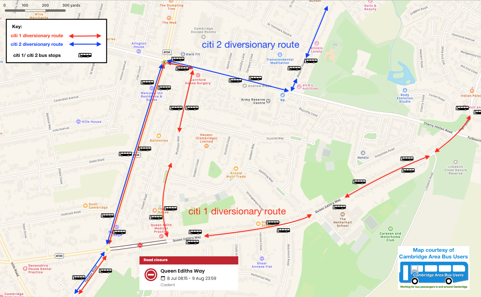
Cambridge Area Bus Users note, from Causeway one.network, that a road closure has been granted for Cadent Gas from Mon 08/07/24 on Queen Edith’s Way, Cambridge between the Fendon Road roundabout and Wulfstan Way. As a result Stagecoach’s citi1/citi2 will be on diversionary routes.

map showing road closure from Fendon Road roundabout to Wulfstan Way
Closure from Fendon Road roundabout to Wulfstan Way

Stagecoach have posted a service update. Following contact with their Cowley Road staff, we can conform these diversionary routes:

  • citi 1 be using Mowbray Road (A1134), Cherry Hinton Road, Wulfstan Road and Queen Edith’s Way between Fendon Road and Cherry Hinton High Street (Robin Hood junction)
  • citi 2 will be using Mowbray Road (A1134) and Cherry Hinton Road between Fendon Road and Walpole Road

The map, below, should help make these diversions clearer.

Non-interactive map showing diversions as described above.
Click the image to view a larger version in a new tab

Beehive Centre Planning Update

Note that this planning application includes a number of bus service enhancement proposals.

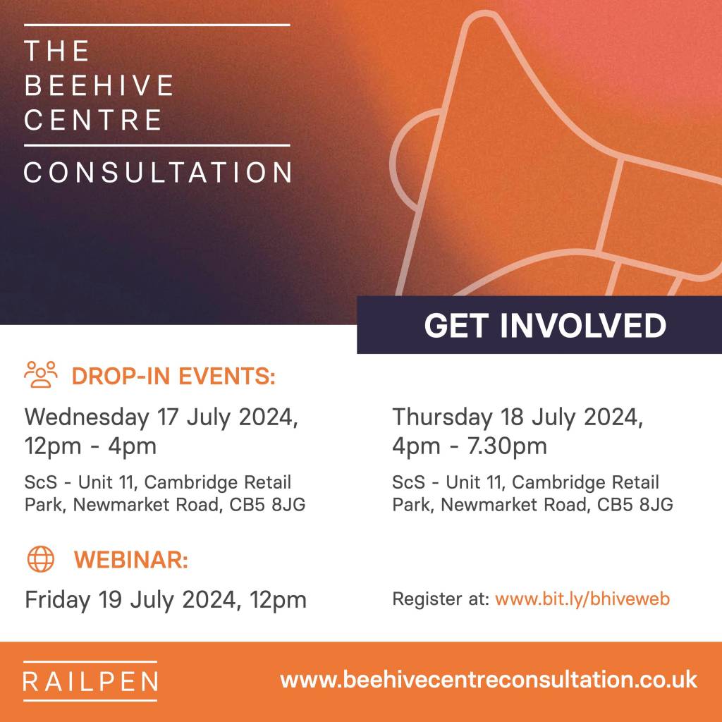
poster text as accompanying text in this post
Click the image to download a printable PDF

Nick Vose​​​​, Director, Marengo Communication, writes:

We are pleased to provide you with an update on Railpen’s proposals for the Beehive Centre.

As you will be aware, we first submitted plans last year, including proposals for new retail, leisure, and community space, as well as laboratory, workspace, and green public space.

However, following feedback on the plans we decided to come back to you with revised designs.

The key uses proposed for the site remain the same, but we have reduced the height and massing of a number of buildings and adjusted building footprints and locations to increase separation distances between buildings and our neighbours.

A new park roughly the same size as St Matthew’s Piece has been introduced and we will plant even more trees (275 in total).

There is also a new direct cycle/pedestrian route through the site and Coldham’s Lane Roundabout will be upgraded to a four-way signalised junction, creating safer connections for pedestrians and cyclists.

Around 20 new shops and leisure facilities, including a small supermarket and gym are included on the ground floor. This is in addition to our plan to invest in Cambridge Retail Park which is also moving forward and will support the re-location of several retailers from the Beehive Centre. The development will also fund an additional 15 public buses per hour with a service extension to the train station, a new service to Milton Park & Ride, as well as new direct services to Cambourne and St Neots, Huntington and St Ives, Ely and Waterbeach. More than 4,200 cycle parking spaces will be created, and 460 car parking spaces – a third of which will provide electric vehicle (EV) charging.

Finally, in response to earlier feedback, we are also looking carefully at how our proposals can help reduce urban temperatures. We know that green spaces, trees, green roofs and vegetation are all very helpful as natural cooling measures and we are planning to replace large areas of concrete with new landscaping, 275 new trees, rain gardens, permeable surfaces and green roofs. In addition, we have committed to undertaking an Urban Greening Factor assessment to evaluate the quality and quantity of green space provided. More commonly used in London this voluntary assessment will demonstrate how green infrastructure has been integral in the design of the development.  Several other design choices will also be taken, including carefully selected materials with a higher albedo, which is the metric for how much incoming sun is reflected by a material surface.

We are still listening and are now inviting residents and stakeholders to comment on these revised plans before we submit an amended planning application.

You can find out more about our updated plans on the 17, 18 and 19 July.

Wednesday 17th July 2024, 12pm – 4pm
ScS – Unit 11 (next to Nando’s), Cambridge Retail Park, Newmarket Road, CB5 8JG

Thursday 18th July 2024, 4pm – 7.30pm
ScS – Unit 11 (next to Nando’s), Cambridge Retail Park, Newmarket Road, CB5 8JG

Friday 19 July 2024, 12 noon
Online webinar: Register here: Beehive Centre Update – Online Webinar Registration

We are also holding a further event for adjacent neighbours on Wednesday 17 July between 6pm and 7.30pm. This event will also be held in the ScS and a separate letter has been sent via the Royal Mail.

Further details of our events are enclosed in the attached community flyer – which has been sent this week to over 6,000 local residents – and we have prepared a social media friendly graphic, also attached, which we are asking stakeholders to share via their own social media channels. 

We look forward to talking you through the latest proposals.

Best regards,
Nick
For and on behalf of Railpen

Bus Lanes – New DfT Guidance

Mark Harper, Secretary of State for Transport has recently issued new guidance on, amongst other things, bus lanes’ the hours of operation. Bus lanes, he asserts, should only operate when needed. Furthermore, ‘surplus funds’ from enforcement should be restricted, Harper believes.

Read the excerpts, quoted below (click the hyperlinks for fuller information, if you’re keen) and see if you can see a logical inconsistency…

At the moment, restrictions on bus lane use are too rigid, creating delays and causing regular fines for drivers. New guidance on bus lanes has also been issued today, to make sure they only operate when it makes sense, like when traffic is heavy enough to delay buses. This will prevent drivers being hit with unfair fines.

News story – Crackdown on anti-driver road schemes and blanket 20mph limits to put local consent first, DfT and The Rt Hon Mark Harper MP, Published 17 March 2024

While this guidance focuses on improving bus services, it is important to recognise the possible impacts on other road users. The Plan for Drivers, published in October 2023, includes a range of measures to ensure smoother journeys. This guidance delivers the commitment to strengthen guidance to make sure bus lanes help rather than hinder traffic.

As set out in the 2024 BSIP guidance, the NBS states that to increase bus use, buses must become attractive to far more people. The key to doing this is making them faster and more reliable. The NBS therefore expects plans for bus priority on roads where there is a frequent bus service, traffic congestion, and the physical space to install it. Bus lanes should be as continuous as they need to be, and have the hours of operation they need to have, to insulate buses from delays caused by traffic congestion and parked vehicles. The Plan for Drivers confirms that this means bus lanes should be provided only where they are needed and should operate only when buses are running or when traffic is heavy enough to cause delays to buses. Bus priority measures should be developed with full consideration of the impacts on other road users. [Our emphasis]

Local Transport Note 1/24: Bus User Priority, Dft, March 2024

Harper has issued, through the DfT, an Open call for evidence – Restricting the generation of surplus funds from traffic contraventions.

On closer inspection the guidance on the hours of operation of bus lanes might seem somewhat illogical.

  • When general motor traffic is light, the existence of a parallel bus lane will make no difference to the progress of general motor traffic.
  • When general motor traffic is heavy, the existence of the bus lane will impede the progress of general motor traffic, but allow buses to continue on their journeys, unimpeded and speedier than a private car.
  • If the aim of bus lane ANPR cameras were to maximise revenue for the relevant highway/transport authority, rather than to deter misuse of the bus lane, having variable hours of operation of bus lanes, not only across the country, but within the same local authority would achieve this end.
  • to achieve consistency of respect for bus lanes when they are needed, 24/7 operation may be desirable. This would also achieve the aim of minimising penalty charges for infractions.

Some roads on which buses operate 24/7 might carry heavy traffic from a city centre to a motorway or an airport, day and night. Other roads may only be busy at office commuting and school-run times, whilst the peak commuting hours on some routes might overlap with shopping journeys. In some areas, Saturday and Sunday tourist visitors might cause more congestion than weekday traffic.

Imagine the close attention to the minutiae of bus lane signage, and to the clock, required of the diligent private car driver wishing to comply with the regulations and to avoid penalties around these (hypothetical) streets:

  • Dover Street – 24/7 operation
  • Folkestone Road – Mon-Fri 7am-10 am, 4pm-7pm
  • Newhaven Boulevard – Mon-Sat 7 am-9am
  • Portsmouth Road – Daily 7am-7pm
  • Southampton Avenue – Mon-Fri 8am-6pm; Sat 9am-7pm
  • Poole Road – Mon-Fri 7am-9:30am, 3:30pm-5pm; Sat 10am-6pm: Sun 10:30am-5:30pm
  • Plymouth Avenue – (Sign faded, try guessing)

Unfortunately, the current obsession with resisting the (non-existent) ‘war on motorists’ potentially delivers this kind of illogical nonsense.

See: The war on motorists: the secret history of a myth as old as cars themselves, Peter Walker, The Guardian, Thu 28 Sep 2023

Your comments are welcome.

Electric buses in Cambridge are quite safe, actually…

As readers might have guessed, this is not the Daily Mail headline, which read…

EXCLUSIVE Britain’s e-bus ticking timebomb: How nearly TWO THOUSAND electric buses worth £800m face urgent recall over fears they could see burst into flames

If you really wish to read the inaccurate, misleading nonsense from Darren Boyle (2 March 2024) in the Daily Mail click here.

If you’d rather check out facts, then click through to this on-line government publication: Investigation into bus fires reported to DVSA from 2020 to 2022, DVSA, 20 July 2023

RouteOne a trade publication, gave a balanced report Fix for potential BYD ADL battery-electric bus recall ‘in hand’ in which they remarked upon…

 … a hysterical report in the Daily Mail claiming uncited fears that affected buses “could see [sic] burst into flames.”

The Mail also quoted FairFuelUK founder and Reform UK candidate for the London mayoral election Howard Cox as claiming that taxpayers will “have to fund these expensive buses being taken off the road.”

op cit, routeone Team, March 6, 2024

Alexander Dennis has issued a safety bulletin to operators of BYD ADL Enviro200EV and Enviro400EV battery-electric buses in relation to a potential recall issue around the heating, ventilation and air-conditioning (HVAC) systems in some of those vehicles.

An under-development permanent fix will be introduced to deal with the problem. DVSA’s recall listing service shows that it affects 1,758 buses produced by the BYD Alexander Dennis partnership. In the meantime, operators have been advised to ensure that the Hispacold HVAC system is switched off when those vehicles are left unattended.

ibid

Not these nine…

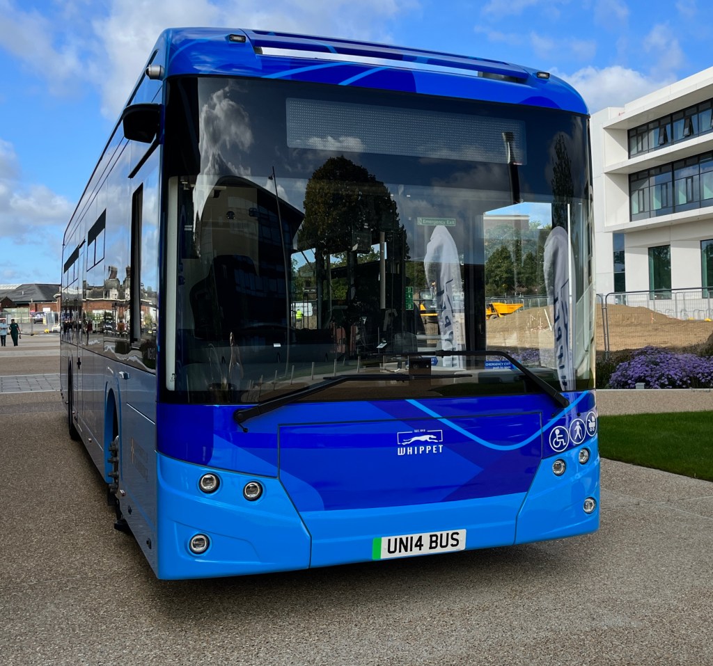
Whippet electric bus
No. None of the nine Mellor Sigma 12 buses serving Whippet’s U1/U2 routes

Nor these thirty…

Stagecoach electric buses outside IWM Duxford
No, Not the Volvo electric buses allocated to the P&R routes and the citi2

So, which? And how many?

Just these two…

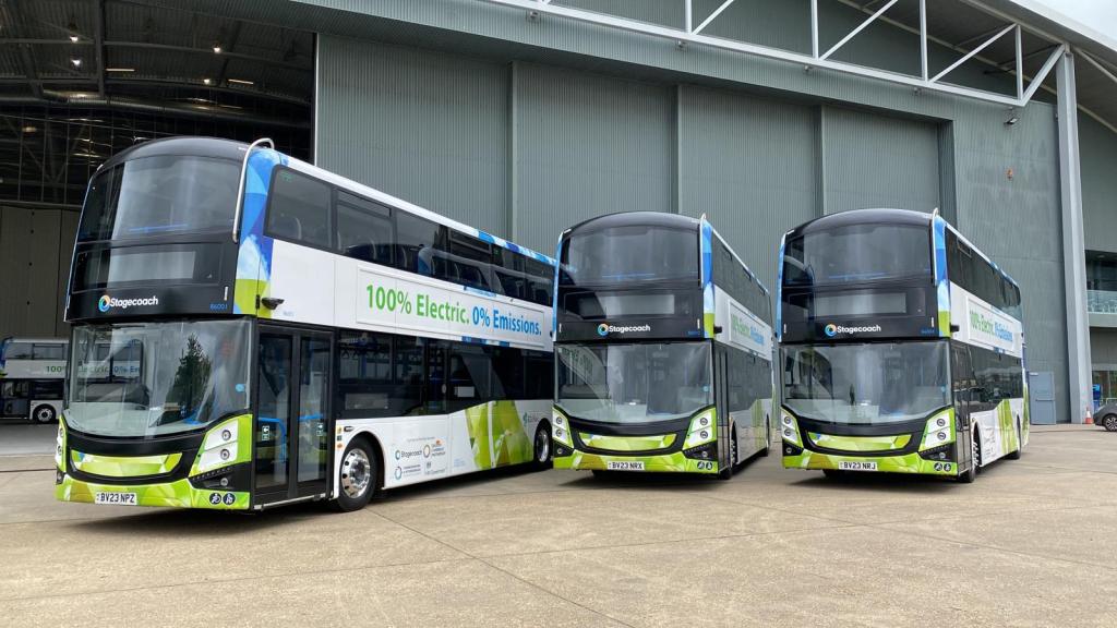
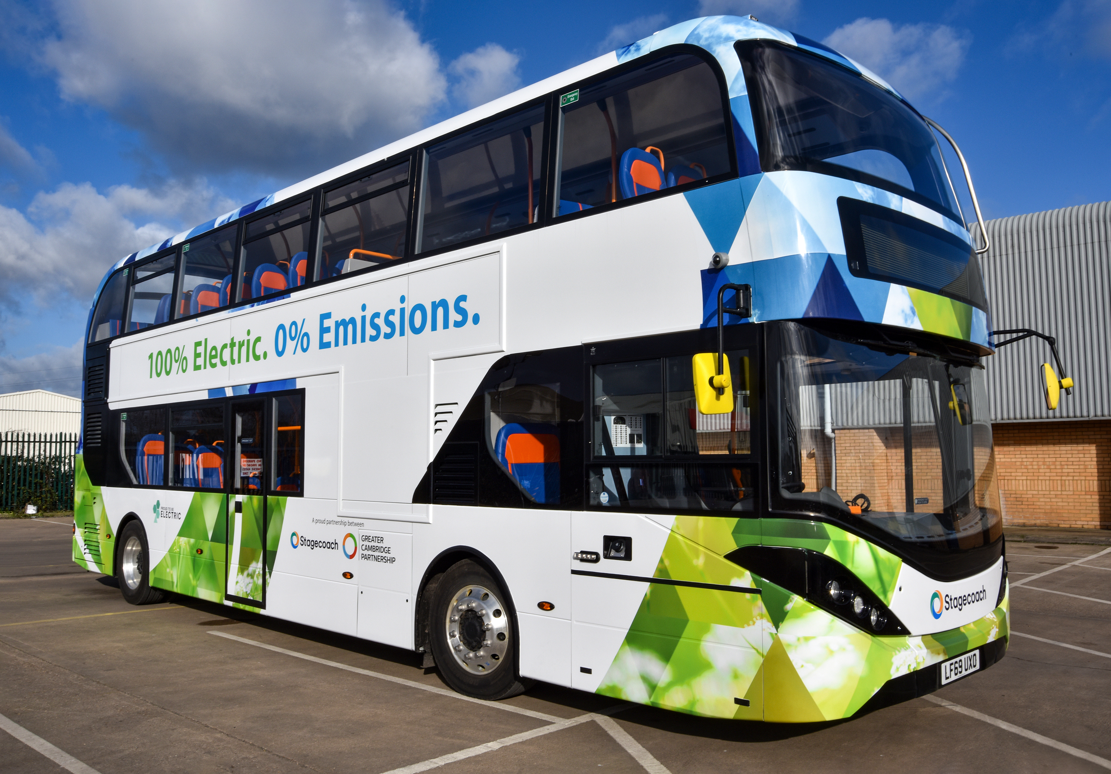
BYD ADL Enviro400EV at Stagecoach's Cowley Road depot
BYD ADL Enviro400EV

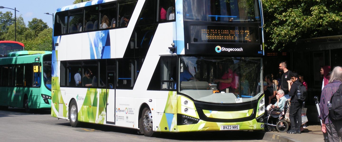
Just these two. ⬆︎ The Alexander Dennis electric double deckers supplied to Stagecoach East for a project between the operator and the Greater Cambridge Partnership, supporting an improvement in air quality in the city centre of Cambridge and giving the opportunity to inform potential future investment in a zero emission bus fleet.

So, these two EXPENSIVE BUSES bought with PUBLIC MONEY are going to be off the road over fears they could burst into flames?

Err… No. Stagecoach drivers and mechanics will ensure that the Hispacold HVAC system is switched off when these vehicles are left unattended, pending a permanent fix from manufacturers ADL.


This puts us in mind of…

There was no wrecks and nobody drownded
‘Fact, nothin’ to laugh at at all!

Stanley Holloway – The Lion And Albert (George Marriott Edgar)

Return to Parkside for citi2

photo as caption
The Volvo electric buses allocated to the citi2 route will serve Parkside

Many years back, before the advent of the Cambridgeshire Guided Busway, Stagecoach’s citi2 route (towards Milton) stopped on Parkside, opposite the Fire Station. Then, as now, in the opposite direction (towards Addenbrooke’s) buses stopped at Mortimer Road (NaPTAN 0500CCITY370).

Cambridge Area Bus Users wondered, with the 905’s move to Drummer Street bus station releasing Parkside, Bay 16 (NaPTAN 0500CCITY476) whether this stop would be available for use by the citi2. So we asked. The response surprised us.

Rather than using Parkside, Bay 16, the citi2 buses will pick up and set down at the stop opposite the Fire Station – now known as The Busway, Parkside (0500CCITY117) – which was previously used.

photo as caption
The Busway Parkside (0500CCITY117) from Google Maps

Cambridge Area Bus Users welcomes this development as the stop…

  • will be useful for Grafton Area shoppers, with a largely traffic-free walking route to Fitzroy Street, via Melbourne Place and Eden Street;
  • will be of some use for passengers to/from Anglia Ruskin University in the evenings and weekends (when the access from Mackenzie Road is closed);
  • will serve students, staff and visitors to Parkside College.

Southern Busway – Planned Reopening

From Stagecoach map annotated by Roger French

Members and others will no doubt have seen reports in the local media about work on the Southern Busway between Hills Road bridge and the Addenbrooke’s Spur Junction, based on this press release –  Guided Busway works begin to allow closure to be lifted, 06 February 2024 – from Cambridgeshire County Council.

Since February 2022, a section of the Guided Busway in one direction has been closed between Cambridge Railway Station and the Cambridge Biomedical Campus. The inbound only track (closest to the maintenance track) was closed to allow for a temporary fence to be installed without reducing the width of the path used by pedestrians and cyclists. This measure has severely impacted the busway service and connections to key employment and health facilities.

The temporary fence was installed whilst we waited for an independent safety review and following ongoing communications with the Health and Safety Executive (HSE) and as part of our continuous review of safety on the busway.

Guided Busway works begin to allow closure to be lifted, Cambridgeshire County Council, 06 February 2024
Photo from bus, showing overgrown northbound track
Photo courtesy of BusAndTrainUser

The busway and the maintenance track (foot and cycle track) are currently programmed to re-open on Saturday 30 March.

The questions, and responses from a Cambridgeshire County Council Highways officer are shown below.

  • What northbound speed limit is proposed on the guideway?

The proposed speed limit will be the 30 mph restriction that was in place before the installation of the safety barrier, and which is in place on all of the operational parts of the southern section

  • Will this be mandated by the HSE, or at the discretion of Cambridgeshire County Council?

There has been no reference made by the HSE as to a required speed limit. As mentioned previously, the pre-existing speed limit will be in place when the closed guideway re-opens. 

  • What is the justification for the 15mph limit on northbound buses leaving the guideway towards Station Place?

The speed limit was lowered to 15 mph several years ago, due to the increasing numbers of pedestrians, cyclists and other non-motorised traffic in this area. There is a transition area directly at the northern end of the Cambridge-bound guideway where cyclists cross between the carriageway and the maintenance track in both directions, and where there is more interaction with pedestrians using the maintenance track and the footpath towards Station Place. In addition, there is subsidiary traffic entering and leaving the same are via the access from the Obsidian development adjacent to the Busway.

  • Could this be raised to a 30mph limit? 

While it would be possible to raise the speed limit to any required level, the Council would not wish to exponentially increase the risk of a collision with non-Busway traffic, and the increased likelihood of major injury or death arising from such an increase. The current speed limit allows bus drivers more time to react to what can be unpredictable movement by non-Busway users.

  • What is the justification for the 30mph limit on the southbound guideway to the Addenbrooke’s spur junction?

The speed limit across the entire southern section was reduced to a blanket level of 30 mph some years ago, largely in response to the increased numbers of pedestrians, cyclists and other non-motorised traffic arising from the construction of new housing developments, and the expansion of the Biomedical Campus at Addenbrooke’s Hospital. The speed limit is also in keeping with those in place on the road network around the Busway corridor.

  • Can the southbound guideway – separated from the cycleway/footway/maintenance track by the northbound guideway, and the new fence – revert to the original 56mph limit?

Whilst it would be possible to raise the pre-existing speed limit to the original speed limit of 56 mph, there is no compelling case to do so. The maximum theoretical transit time gained through increasing the speed limit to 56 mph over this limited distance would be approximately 62 seconds, assuming that a bus entered and left this section of guideway at that speed. However, as the speed limits at either end of the section would be lower, there would be a period on entry where a bus would need to accelerate to the maximum permitted speed, and subsequently a period where the bus would need to decelerate before exiting the guideway to match the speed limit in place at the end of the guideway. These actions would reduce the gains in transit time well below the theoretical maximum.

In addition, and possibly of a greater impact , all buses that use the southern section have their speeds regulated by on-bus control systems using GPS-based geo-fencing. The accuracy of these systems does not have sufficient accuracy to allow for differing speeds on the guideway tracks that are immediately adjacent to each other.

  • If the 30mph limit is mandated by the HSE, will the County Council and Combined Authority press the HSE to allow the limit to be raised?

As stated above, the HSE have not made reference to any required speed limit in the southern section. The rationale for the 30 mph has already been addressed in my response regarding your question on the 30 mph limit on the southbound guideway. As I have already stated, there is no compelling case to increase the speed limit, and the technology in use to regulate bus speeds currently in use would preclude a separate speed limit for one section of guideway in this section.

  • Whilst a 15mph limit is required for southbound buses at the point of entry to the southbound guideway, why does this apply from the junction with Station Place?

The reasons are the same as stated above, in response to your question regarding the 15 mph speed limit for buses leaving the northbound guideway.

  • Could this apply only from the overhead hanging height limit warning signs before the Hills Road bridge, with the 30mph limit applicable in Station Place continuing up to this point?

As outlined above, given the levels of non-Busway traffic using the area, there would be little to gain by doubling the speed limit for buses over such a short distance, and any gains in transit time would be negligible. The area between Station Place and the height restriction barrier is where large numbers of pedestrians cross the roadway from the station side to reach the path that eventually joins the maintenance track adjacent to the guideway south of Hills Road bridge, and an increase in the speed limit would increase the likelihood and severity of a collision between buses and non-Busway traffic.


We look forward to the re-opening and, even with the lower speed limits in both directions, buses will, once again be able to avoid the traffic congestion on Hills Road (which the Greater Cambridge Partnership and others seems reluctant to tackle).

Photo courtesy of BusAndTrainUser

The images displayed here are from BusAndTrainUser the retirement activity for Roger French OBE DL MA, former MD of Brighton&Hove Bus Cº, a blogging site which we are pleased to promote.

Cambridgeshire Buses Feedback Forum

image of toy bus
text as per subsequent paragraphs
Click the image to book a place

Long Road Sixth Form College are running an event regarding bus services across Cambridgeshire and surrounding areas, on Tuesday 5th March 2024 5:30pm – 7:00pm.

Pre-booking is required. Click here to book, and for full information. Booking closes at 4pm on Tuesday 5th March.

Since the changes to bus routes in October 2022, many local communities have found their bus service to be less than satisfactory; an issue that is particularly impacting young people accessing a variety of educational, work and social opportunities. We want this to change. 

Share your questions and feedback with Mayor Dr Nik Johnson of Cambridgeshire and Peterborough Combined Authority (our Transport Authority) who are raising additional Council Tax to fund more bus services, and representatives of bus companies Stagecoach, Whippet and Stephensons of Essex, who will be able to talk about any of their bus services; giving young people and their families the opportunity to share their feedback and get their questions answered.

Important information for attendees:

  • You must book 1 ticket for each person attending the event, including parents/carers.
  • On-campus parking is available. Please use public transport or car-share where possible.
  • Long Road Sixth Form College will be taking photos for use in their marketing materials and social media. If you would not like to be photographed please alert their photographer(s) when you see them, or move out of shot.